

September 2009
Including US-385 from “Bottom to Top”
Saturday, 8 August 2009, marked the end of 16 days and 6,385 miles off the grid and on the road for the Princess, HiDalgo and me. Our route was from Miami Beach Florida to Terlingua Texas to Gillette Wyoming–our base for the 69th annual Black Hills Trailer Classic in and around Sturgis–and from there back home via Wounded Knee, Sioux City, Indianapolis, Cincinnati, Knoxville and Deal’s Gap TN2NC. Here are our map links going and coming back:
http://tinyurl.com/09miami2sturgis
http://tinyurl.com/09sturgis2miami
As part of this roundabout ride to Sturgis, we followed highway US-385 from its southern terminus in Big Bend National Park some 1,200-plus miles through Texas, Oklahoma, Colorado, Nebraska, and South Dakota to its northern end at the city limits of Deadwood:
http://tinyurl.com/us385bigbend2deadwood
But before passing on further high points of the pilgrimage, let me say thanks for the following:
First … aside from a summer shower east of Tallahassee FL that barely got us wet … and a 70mph-gusting hail and Hell’s fury thunderstorm west of Sundance WY that nearly blew us away … we encountered no other rain or bad weather.
Second … although I’d say about half the asphalt we rode on was either under repair or in need of it, we hit no potholes deep enough to blow a tire or bend a wheel, and no tar snakes or pavement seams serious enough to cause us to lose control.
Third … despite the fact that most of the discretionarily-distracted cagers we encountered were paying more attention to their discourse than their driving, we managed to cross 3 time zones and 18 states without becoming a hood ornament.
This “bikation” was a testament to the fact that motorcycle touring is more about the journey than the destination. Of our 6,385 miles in the saddle, 3,356 were logged getting there and 2,579 getting back, leaving only 450 miles ridden around “the Rally”. And out of 16 days on the road, only one was actually spent in Sturgis proper. Here’s what we did the rest of the time:
Day 1: Miami Beach FL to Tallahassee FL (Fri 07/24/09, 482 miles)
Our ride up from SoBe on the Florida Turnpike then north on IH-75 was typically non-remarkable, at least until we stopped for gas near Gainesville. There, turning the key failed to light up my engine/oil/neutral indicators, and my Start button wouldn’t. Experience told me it was time to replace HiDalgo’s second ignition switch with a third, but first I had to get her to a wrench with the parts. Luckily, ten minutes and a few dozen on-off jiggles later, I was able to connect the wires and light the fires one last time, and push on to the nearest safe haven for what Uncle Harley’s service writers call “stranded travelers”. And from there, it was a short ride through a warm summer shower to our evening’s destination, the Sleep Inn of Tallahassee.
After checking in, I called my rider radical counterpart Robert “RC” Conroy and his sweet lady Kim to join us for pizza and a brief reunion. And as if we were munching on coca leaves (we weren’t … really) RC and I talked for hours, coming close to identifying solutions for every major problem facing bikers, America, the human race and the known universe. But alas, as they say, “…’close’ only counts with horseshoes and hand grenades.”
Day 2: Tallahassee FL to Lake Charles LA (Sat 07/25/09, 567 miles)
Starting out early, we made good time crossing the remainder of the Florida Panhandle, Alabama, Mississippi and Louisiana, taking IH-10/IH-12/IH-10 to reach Lake Charles by early afternoon. There, longtime friends Jeff and Linda Seagle were kind enough to comp a two-night stay for us at the Isle of Capri Casino’s Inn at the Isle. Jeff and Linda are former motorcycle riders, having given up on two-wheeled transport after a care-less cager who “didn’t see them” turned left in front of their cruiser a few years ago, causing a serious accident that left them with permanent emotional if not physical scars. Jeff maintains that a universal “left turn on green arrow only” law would’ve prevented that accident, as well as untold thousands of other failure-to-yield and right-of-way-violation (FTY-ROWV) casualties.
Day 3: Lake Charles LA (Sun 07/26/09, 0 miles)
We stayed an extra day at the Isle of Capri not to gamble but to spend more time with Jeff and Linda. We also managed to arrange a meeting to discuss FTY-ROWV mitigation strategies with local residents Carl and Elizabeth Webb, whose 26-year old son David was killed on 11 April when care-less cager Tracy Armstrong ran a stop sign and turned left in front of his motorcycle. I am honored to say we were joined in that meeting by Motorcycle Awareness Campaign activists from Baton Rouge – including FTY-ROWV survivor Amy Pickholtz, who was seriously injured and whose husband Jim was killed in a crash caused when former Sorrento LA Mayor Brenda Melancon pulled out in front of their motorcycle on 14 October 2007.
Day 4: Lake Charles LA to Del Rio TX (Mon 07/27/09, 491 miles)
On this day, we stopped worrying about defending our right-to-ride (for a while, anyway) and instead started enjoying it. Heading west on IH-10, it took less than half an hour to reach the border of the Lone Star State, and from there we had sunny skies and smooth sailing all the way through Houston and deep into the heart of Texas at San Antonio. From the Alamo City, we left the relative safety of the interstate system and continued west on US-90 to the border town of Del Rio, following the same route I’d covered some eighteen months earlier.
What I had to say then about Del Rio bears repeating: Located just across the Rio Grande River from Ciudad Acuna Mexico, Del Rio can be considered a “border” town in more ways than one. As you’ll learn from logging onto Wikipedia.org, “Del Rio lies on the northwestern edges of the Tamulipan Thornscrub, also called the South Texas Brush Country. It is also near the southwestern corner of the Edwards Plateau, which is the western fringe of the famous, oak savanna-covered Texas Hill Country.” And that puts Del Rio right smack dab at the eastern edge of the West Texas region of the 140,000 square-mile Chihuahuan Desert.
Just inside Del Rio’s city limits, I pulled into T&T Cycles to thank the gang there for witnessing an Iron Butt ride for me back in 2008. And a lucky stop it was indeed… Saddling up to leave, I turned the key on my new ignition switch and nothing happened. Nada… But only minutes after I walked back in and asked for help, T&T’s master mechanic had isolated the problem, re-soldered a poor connection made by the wrench from three days earlier, and had HiDalgo ready to ride again.
I shudder to think what the consequences might have been if this break had happened a little earlier or a little later than it did, as either way we would’ve been in the middle of nowhere … in 100+ degree heat … and thanks to my believing AT&T’s “more bars in more places” BS, most likely without a cell phone signal. Instead (thank God) we rolled on into town, took a room at the Best Western’s Inn of Del Rio, and then took our own sweet time washing the South Texas dust out of our throats and heat out of our systems with some perfectly-blended top-shelf margaritas procured at a nearby Tex-Mex cantina that producers of “Anthony Bourdain: No Reservations” might easily have overlooked.
Day 5: Del Rio TX to Fort Davis TX (Tue 07/28/09, 237 miles)
 One of many things I enjoy about motorcycle touring is the changes in landscape as you ride from one point to the next, especially where those transitions are sudden and abrupt. Just west of Del Rio and Lake Amistad, where US-90 crosses the Pecos River, is such a place. It was early in the morning when we made that crossing, and from that point on there was a marked contrast between the flat, mesquite-covered brush country of the South Texas Plains behind us and the rolling expanse of rocky buttes, rounded mesas and endless canyons dotted with cactus and sage typifying the vast Chihuahuan Desert ahead. And if ever there was a good place to plant a “Welcome to West Texas!” sign, this would be it!
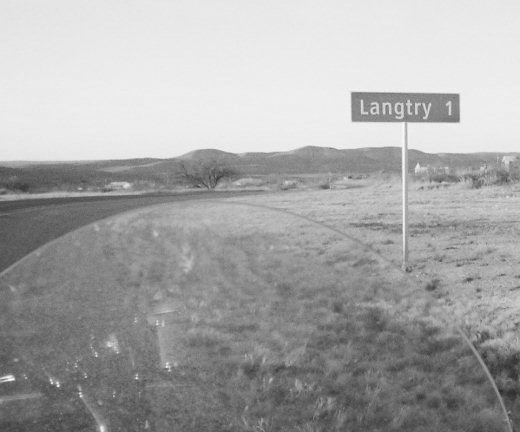 Minutes later, we turned left on Loop 25 into Langtry, where we were made welcome by the friendly ladies running the State of Texas’ Judge Roy Bean Visitor Center. Among other valuable freebies (especially for those not fortunate enough to have been raised in Alamo Country) they gave us a copy of the 272-page Texas 2009 State Travel Guide, which you can order free online. Leaving Langtry, the road was pretty much ours alone on into Sanderson … the “Cactus Capital of Texas” … factual home of the Buzzard Rally … and better known as the fictional setting for the blockbuster film, “No Country for Old Men”. There we gassed up, posed for photos requested by a busload of Mexican missionaries, then continued west on 90 through Marathon to Alpine, “the Hub of the Big Bend”. There we turned north on Texas Highway 118 into the Davis Mountains, which look a lot like the Black Hills but with red rock formations instead of gray
We soon arrived in Fort Davis, where we spent a leisurely afternoon doing a whole bunch of nothing in our affordably comfortable mini-suite at the Stone Village Tourist Camp.
Day 6: Fort Davis TX to Terlingua TX (Wed 07/29/09, 208 miles)
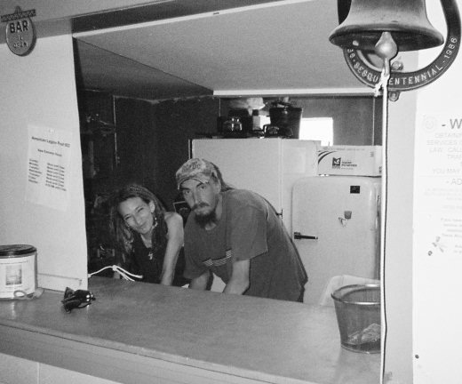 A thunderstorm had passed over during the night, and the lightning over the mountains was a sight to see. But by dawn the skies were clear, so we packed up and headed back down 118. Terlingua is only 107 miles away by that route, but we did a little rambling which required us to log another 101. Just off of 118, for example, I have a rock ranch I wanted to inspect. And after walking the 10-acre perimeter with black leathers soaking up the scorching desert sun, a stop for a few cold ones with Sherri and the rest of the fine biker-friendly folks at “The Last Outpost” (a.k.a. American Legion Post 653) was certainly in order. Our thirst quenched, we rode on south to the Terlingua “T” (Ranch Road 170 at Texas 118) where we stopped to fill our bellies with some mouth-watering Tex-Mex soft tacos al carbon at the Chili Pepper Cafe. Then we crossed the highway, checked into the overpriced and under-accommodating Big Bend Motor Inn, and rested up for the long ride north up US-385 to the Black Hills that would commence the following day.
Day 7(a): Terlingua TX to Panther Junction TX (Thu 07/30/09, 25 miles)
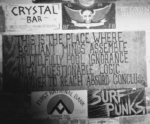 A mile south of the Terlingua “T” on the east side of 118 is the one-of-a-kind Study Butte Store, which is arguably the most hippy-cool and eclectic desert roadside oasis on the planet. We stopped there just before dawn to gas up and exchange pleasantries with Diane at the register. Then, with the early morning sun just beginning to silhouette the peaks and ridges of the Chisos Mountains before us, we headed east into Big Bend National Park:
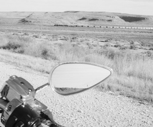
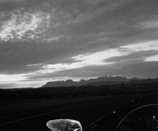 I have neither the words to express now, nor the photographic skills to capture then, the spectacular natural panorama that played out over the next 24 miles. The warming golden sun rising over majestic purple (yes, purple) mountains to the east cast both light and shadow over the cactus-dotted basin and monolithic buttes surrounding us, creating an impression I can best describe as primordial. Except for the single narrow strip of blacktop snaking over the jagged hills and painted desert floor, I recall no evidence of human existence whatsoever. And in fact, if this had been a movie in need of a theme, my choice would be the music used in 2001: A Space Odyssey’s Dawn of Man sequence, “Also Sprach Zarathustra”.
[~~~ Start of the ride up US-385 ~~~]
Day 7(b): Panther Junction TX to Dalhart TX (Thu 07/30/09, 546 miles)
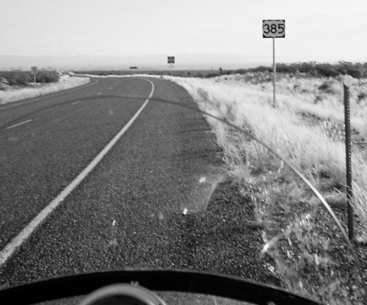 Still deep inside the 801,163 acres of Big Bend National Park, at Panther Junction we turned north on the road that would become US-385, stopping 28 scenic miles later to photo the first highway marker just north of the park boundary. Just past that point, our ride was nearly brought to an abrupt end when a good-sized deer darted onto the road at a creek crossing and started running parallel to our course. I prayed it would not break left as we overtook it, and Somebody must have heard me. Anyway, from there we continued north through Marathon, Fort Stockton, McCamey and Crane to Odessa, the “Jackrabbit-Roping Capital of Texas”, “Oilfield Supply Capital of the World”, and together with its sister city Midland, hub of the energy- (oil, gas and now wind) based Permian Basin.
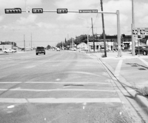 Like Route 66, US-385 is a highway that takes you back to a slower, simpler, less complicated and more enjoyable time. And all along the way are nostalgically appealing little townships all but lost to history, yet each proudly clinging to unique claims to fame. About 150 miles north of Odessa, for example, we rode through the small South Plains hamlet of Littlefield, crossing over a bumpy thoroughfare named for favorite son and country music legend Waylon Jennings. Riding 150 miles more across high, grassy plains and through deep, fertile canyons brought us near the top of the Texas Panhandle. And there we found a far richer slice of Americana–the “XIT City” of Dalhart–so nicknamed for its association with the world-famous but ill-fated 3 million acre XIT Ranch (whose spread over ten counties in Texas did not inspire the name).
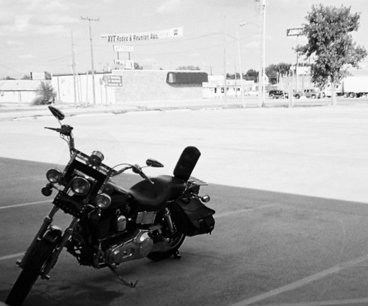 Dalhart is the home of the XIT museum … the headquarters for the annual XIT Rodeo and Reunion … and the site of the Empty Saddle Monument–commemorating the XIT cowhands and other pioneers who died settling the Panhandle. A stone’s throw south of it, we checked in for the night at the EconoLodge.
Day 8: Dalhart TX to Chadron NE (Fri 07/31/09, 549 miles)
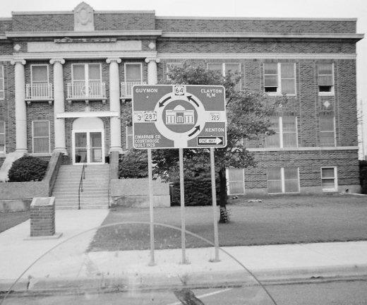
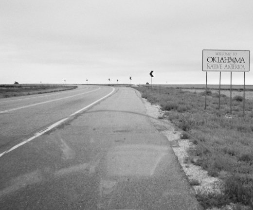 After taking in our fill of complimentary boiled eggs and coffee, a short ride north took us across the border into the Oklahoma Panhandle. This 5,687 square-mile rectangle (larger than Connecticut) was once part of the Republic of Texas, but was surrendered as part of the Compromise of 1850 to become the “Public Land Strip” … more commonly referred to as “No Man’s Land” … and later the “Cimarron Territory” before finally being absorbed into the Oklahoma Territory in 1890. Near the midpoint of this Strip we stopped for gas in Boise (pronounced like “voice”) City, where the turnabout-centered Cimarron County Courthouse seemed to symbolize all that is just and good about America.
 The history of Boise City, however, reflects anything but: First of all, it was founded in 1908 by two swindlers who were sent to Leavenworth for defrauding the original settlers suckered into the area by promises of a paradise that didn’t exist. Then a few years later, those too proud or too poor (or both) to move on found themselves smack dab in the epicenter of the “Dust Bowl” for the duration of the Great Depression. And if that wasn’t bad enough … just after midnight on 5 July 1943 Boise City became the only city in the continental U.S. ever bombed during World War II (two B-17 pilots mistook the town square for a training target). Oh well … if what doesn’t kill us makes us stronger, there must be some tough friggin’ Okies in Boise City!
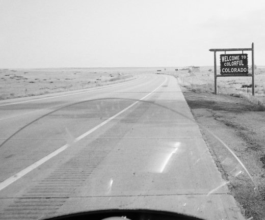 We managed to make it out of there without getting ripped off, blown away or bombed, and soon crossed the border into southeastern Colorado. We entered the Mountain Time Zone, but there are no mountains here: Only miles and miles of miles and miles of grasslands. Not too many people, either: Just long lonesome stretches of straight open road and plenty of temptation to twist the throttle. We made good time to Lamar … then lost some of it finding the dogleg east to Granada that 385 shares with US-50. There 385 turned north again, through farmland so near to Kansas I thought we’d see Dorothy.
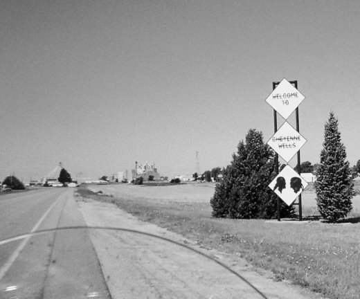 The serenity of the heartland that surrounded us for the next 55 miles was so pervasive as to border on disturbing. That brought us to Cheyenne Wells. And from there to historic Julesburg, a station in the old Pony Express named after a horse thief, US-385 would be co-branded as the “High Plains Highway”.
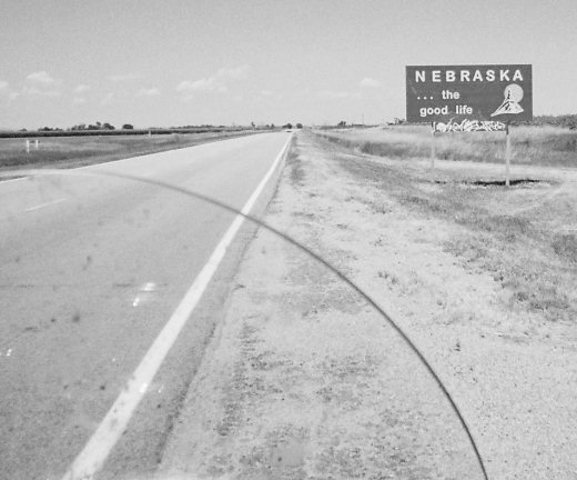 We had enjoyed open roads, light traffic, beautiful scenery and perfect weather all the way so far, and the temptation to ride lidless and take it all in had been too great to resist. Safety concerns aside, riding bareheaded was not an issue in the freedom-of-choice states of Texas, Oklahoma and Colorado. But crossing the line just north of Julesburg, I was reminded that Nebraska still has a mandatory lid law. I pulled over for a moment, and gave that some thought. But after carefully weighing the possible price I might pay for defying an unjust mandate against the importance of preserving my freedom to ride where I want and wearing what I choose, I opted for the latter: I rode on through Lodgepole … where 385 briefly shares pavement with US-30, the Lincoln Highway, and then on into Chadron, with my brain bucket strapped to my right saddlebag. There, we got a good room at a good rate from the good people at Economy 9 Motel, where we spent a good evening sharing tales of the road with Rocky, a rider from Idaho that I’d buy a beer or block a bullet for anytime.
Day 9(a): Chadron NE to Deadwood SD (Sat 08/01/09, 141 miles)
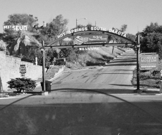 From scenic Chadron it was a short ride into South Dakota, the Black Hills and Hot Springs. And as soon as the innkeepers and merchants of Chadron convince the Nebraska Legislature to give motorcycle riders the freedom to choose what they wear when they ride, they can all expect more biker bucks from me. Continuing on up 385 we soon rode into the Wind Cave National Park, on whose 28,295 acres you might spy just as many prairie dogs and bison up close and for free as you would pay to see in nearby Custer State Park:
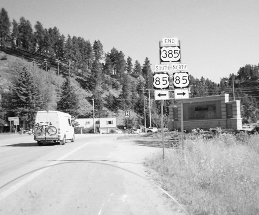 We were now in the heart of the Black Hills, and the remaining ride of 80 miles or so through Custer and Hill City to the Deadwood City limits (at Pluma) and the northern end of US-385 were as enjoyable as they come.
[~~~ End of the ride up US-385 ~~~]
Day 9(b): Deadwood SD to Gillette WY (Sat 08/01/09, 110 miles)
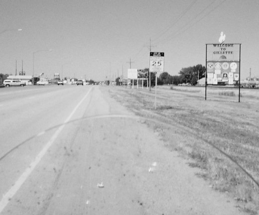 From Deadwood it was a short hop up US-85 to IH-90 west, which took us the remaining miles to Wyoming and our “base camp” for Sturgis, the National 9 Inn of Gillette. With biker-friendly manager Debra Curley, her courteous staff, affordable rates, cable TV, refrigerator, microwave, 24-hour coffee, room service, a built-in cafe and lounge, swimming pool and a laundromat next door, the National 9 may be 118 miles from Sturgis but it’s still a great place to stay for “the Rally”. We arrived there at noon, checked in and greeted our friends, stowed our gear in the room, and made tracks for Jake’s Tavern.
Days 10-12: “Sturgis” (Sun-Tue 08/02-04/09, 450 miles)
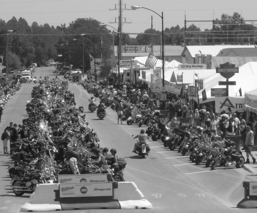 For some, “Sturgis” is a place … a small dot on a South Dakota map. It is, but it’s more than that. For others, “Sturgis” is a party … a week-long binge at the Buffalo Chip. It can be (sadly), but it’s more than that. For me, “Sturgis” is a pilgrimage … a long, steam-letting, soul-cleansing, mind-clearing journey … a truly spiritual experience that can take you as close to Heaven as a biker may ever get, at least while his boots are still planted above ground. And trust me, friends … you will never share that experience towing a “Live to Ride” trailer.
“Sturgis” is (or should be, anyway) about “the Ride” more so than the Rally. So I will say no more about “the Rally” here … knowing you can read about it elsewhere ad nauseum … other than to note that except for the increasing age and decreasing number of the attendees, not much has changed in the past few years.
Day 13: Gillette WY to Sioux City IA (Wed 08/05/09, 599 miles)
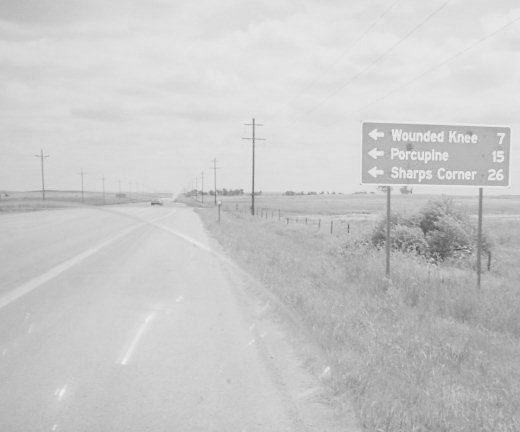 Beginning a long and winding route back to South Florida this day, we headed east out of Gillette on IH-90, then southeast on US-16 through Moorcroft, Upton and Newcastle, continuing across the South Dakota border once more into the Black Hills and Custer. From there, we followed US-385 south through Hot Springs to US-18, which took us eastward into Pine Ridge … our 8th largest Indian reservation (bigger than Delaware and Rhode Island combined) … and one of the poorest places in America. That was clearly evidenced all along our route, and at our stop in Wounded Knee.
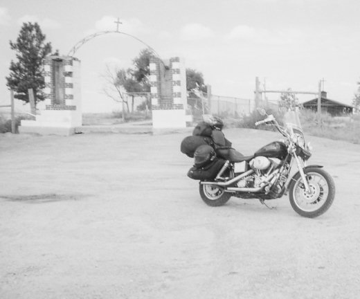 On 29 December 1890 (two weeks after the assassination of Sitting Bull), Wounded Knee was the site of the last armed struggle between Uncle Sam and the Sioux Nation. It was a short but bloody massacre in which over 300 cold and hungry Lakota Sioux Indians–mostly innocent women, children, and men to old or too sick to fight–were mowed down by 500 troopers of the 7th Cavalry supported by four Hotchkiss guns. Today, Wounded Knee is the site of a mass grave with a modest granite obelisk, a ramshackle “museum”, and a faded roadside marker all of which suggest that neither White man nor Red care to remember what happened there.
With much to ponder, we returned to 18 and continued east, eventually exiting the reservations and passing through uncounted miles of green crops and fat cattle. We crossed the Missouri River over the Fort Randall Dam that forms Lake Francis Case, and stopped for gas (and a huge bag of Sugar River Beef Stick Ends and Pieces) in Pickstown, a childhood home of Tom Brokaw, one of America’s last credible television journalists. From there, it was a straight shot across SD-46 to Beresford. Then we took IH-29 south into Iowa, stopping for the night on the south side of Sioux City at the all-night Truck Haven’s priced-right Haven Inn Motel.
Day 14: Sioux City IA to Shelbyville IN (Thu 08/06/09, 702 miles)
 From Sioux City we continued south on IH-29 to IH-680, where we turned to head east across the entire state of Iowa on IH-80. The 300 miles or so that followed can be summarized thusly: Cornfields … Des Moines … and more cornfields. That brought us to Davenport, where we looped down IH-280 across the Mississippi River into Illinois, then took IH-74 and nursed our reserve to reach Exit 24 and gas at the Casey’s across from the pond in Andover. We then rode 200 miles more through cornfields, Galesburg, more cornfields, Peoria, more cornfields, Bloomington, more cornfields, Champaign, more cornfields, and Danville to the Indiana border.
Another 100 miles brought us to the IH-465 loop at Indianapolis, where with 5 o’clock rush hour approaching we stopped only for gas and some Arizona Iced Tea before continuing southeast on IH-74. That took us to Shelbyville, a quaint little town whose claims to fame include being the final residence of both Sandy Allen, who at 7 feet 7.25 inches was once the World’s Tallest Woman, and Edna Parker, who was the World’s Oldest Person before passing after 115 years and 220 days. Unaware of any of that at the time, we stopped there for the evening and took a cheap room at the Knight’s Inn.
Day 15: Shelbyville IN to Acworth GA (Fri 08/07/09, 556 miles)
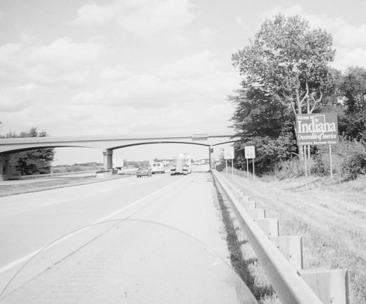
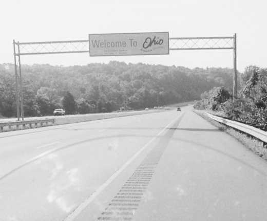 After washing down a forgettable complimentary breakfast with some surprisingly good coffee, it was a short 60-mile ride down IH-74 to the Ohio state line. There we gassed up in Harrison, then followed IH-275 to bypass Cincinnati, loop briefly back into Indiana, and cross the mist-covered Ohio River into Kentucky.
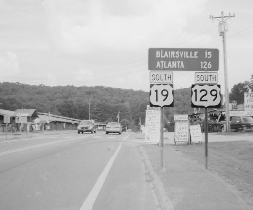
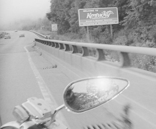 We then took IH-75 heading south, and for the next 240 miles or so had smooth roads and increasingly beautiful scenery as we ascended from the Ohio River Valley to the Appalachian foothills of Kentucky and then on into the mountains of eastern Tennessee. In Knoxville, we merged onto IH-40 westbound, took Exit 386B to the northern terminus of the Alcoa Highway (US-129), and from there followed the highway markers not yet boosted to the Great Smoky Mountains and the Tennessee end of the 318 curves in 11 miles which form the “Tail of the Dragon” at Deal’s Gap.
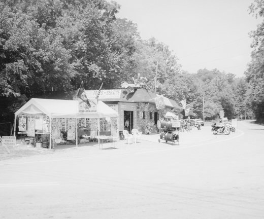 At Punkin Center, we stopped and walked across the road to buy a couple of “I Rode Mine” patches from Brett (if I remember his name correctly) and have him sew them on our vests. After sewing on mine, he scanned the other patches for a moment, and then told me the needlework on some of them looked familiar. Well as it turns out, Brett was once the apprentice of “Mary”, the takes-no-gruff grandma-lookin’ lady who sews on my “Sturgis” patch every year in her tent on Main not far from H-D! Small world, huh?
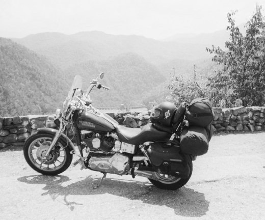 From there we began our run up the Dragon’s tail … under often dense forest canopy, and through seemingly endless curves and switchbacks … stopping only once we’d reached the overlook at Calderwood Dam.
 Obligatory photos taken, we rode on through yet another gauntlet of curves and switchbacks that ultimately delivered us to the North Carolina border, and just beyond that to Deal’s Gap Motorcycle Resort. Here again we stopped to take photos and make friends, then continued our winding route south on US-129 into northern Georgia. Once there, we followed the sun westward to return to IH-75, then rode on towards Atlanta as far as Acworth, where we stopped and spent a comfortable night at the no-frills Econolodge.
Day 16: Acworth GA to Miami Beach FL (Sat 08/08/09, 722 miles)
Having been on the road and off the grid for two gloriously rejuvenating weeks and then some, it was at long last time to return to the daily grind. So through Atlanta and on down IH-75 to Florida we raced … there taking IH-10 east to Jacksonville … and finally IH-95 south to SoBe and the closest thing this Texas Exile has to calling “home”.
* * *
I wish you all could’ve joined us on this journey … I hope you all enjoyed reading this log of the ride … and may sharing these memories inspire you to mount up and make more of your own!
Until Next Time … Ride Long, Ride Free!
Bruce Arnold aka IronBoltBruce
Bruce@LdrLongDistanceRider.com
Author and Publisher, LdrLongDistanceRider.com
Co-Moderator, Bruce-n-RC’s Biker Forum
Mile Eater Gold Member, Iron Butt Association (IBA)
Sustaining Member, Motorcycle Riders Foundation (MRF)
2009 Chairman’s Circle, American Motorcyclist Association (AMA)

You must be logged in to post a comment.