

March 2010
Iron Butt Rides #40 and #41
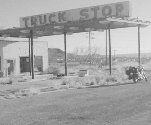
At 4:53am ET on Monday, 16 February 2009, I pulled an ATM receipt at the SoBe Wachovia marking the end of 8 days and 4084 miles in the saddle. I began this trip with my 40th Iron Butt ride and 19th Bun Burner GOLD (BBG1500), a 1583 mile run from Miami Beach FL to Ozona TX completed in 21 hours 43 minutes for an MTH of 72.89. I ended it with my 41st Iron Butt ride and 20th Bun Burner GOLD, a 1521 mile run from San Antonio TX to Montgomery AL to Miami Beach FL completed in 20 hours 58 minutes for an MTH of 72.54.
Between these runs I managed to marry off a beautiful daughter … piss off a prevaricating forum moderator … fight off a bullshit ticket … and cruise 980 relaxing and scenic miles of the Lone Star State, with stops that included:
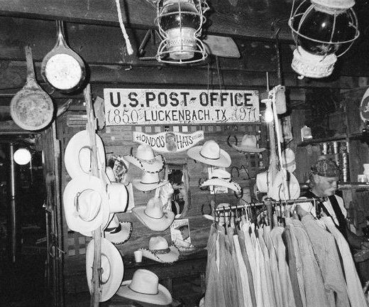 Luckenbach … where the Harley-riding but otherwise reminiscently Jerry Jeff Walker-ish Texas balladeer Jimmy Lee Jones was sittin’ on a log by the stove in the store, pickin’ and singin’ for beer;
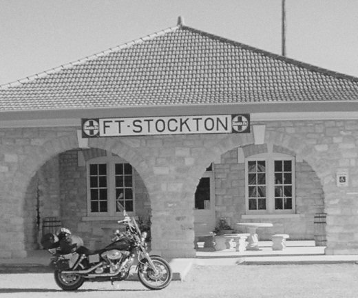 Fort Stockton … once HQ for the U.S. Army’s 9th Cavalry Buffalo Soldiers, an all African-American regiment given that nickname by the Native American Indians because their curly black hair reminded them of a bison’s mane;
 Imperial … a sandy played-out oil patch in Pecos County I own a piece of (that I could not get to because an unmanaged reservoir had flooded the road) named by land developers after the Imperial Valley in California, in hopes that investors (i.e. suckers like me) would be convinced that irrigation might yield a similar agricultural miracle;
 Van Horn … where just 30 minutes after my warm and sunny midday arrival, the temperature dropped almost 30 degrees as a massive red sandstorm blew in, consuming the sky, blocking the sun and delaying my chance to chow down at Chuy’s, where aerophobic sports announcer John Madden’s bus always stops for a “#21”; and
 Sierra Blanca … site of John Wayne’s and Celine Dion’s crumbling Mile High Clubhouse, an unfinished architectural marvel with majestic middle-of-nowhere desert mountain vistas, and the cactus-flowered centerpiece of an ultra-exclusive celebrity getaway real estate (misad)venture that years ago went bust before it ever bloomed.
There is “more to the story” for each of these, but for now I will focus on my last stop in Sierra Blanca. More specifically, let me tell you about the last three miles:
A few years ago I picked up a small strip of land outside Sierra Blanca, and one of my goals for this trip was to ride by and give it a visual inspection, using my Garmin GPS to find the corners and walk the perimeter. According to Google Earth, there appeared to be at least two routes to get there, albeit over dirt and gravel roads for the final stretch. Google Maps showed one of them running right off the IH-10 frontage road, so I didn’t anticipate any serious problems.
Unfortunately, sometimes Google Maps is not correct … and this was one of those times. The recommended exit off IH-10 did not exist, so I was forced to make a long loop back around from the next exit to get to where I thought I needed to be on the frontage road. And having done so, the road I expected wasn’t there. I cruised on west another mile or so and finally found it, but it had been fenced over with no gate, no cattle guard, and no other means of access.
 OK, Plan B… My only alternative required that I backtrack east a few miles, head north to the Mile High Clubhouse, then cut west between two rounded peaks to get to the next valley and my land. The route was longer and complicated by several more forks and turn-offs, but it was that way or no way. The good news was I had mostly paved roads right to the center of the ruined resort. The bad news began at the “State of Texas General Land Office: No Trespassing” sign. From there on, what Google Maps called a “road” was really more of a jeep trail … in a couple of places, not much more than a goat path:
“Man!” I thought, “What a great place to do some dirt bike riding!”
The only problem was, I was riding a fully-loaded H-D street cruiser. Ugh! Rumbling over shifting rock piles and fish-tailing through soft sand patches was challenging enough. But even worse was nursing the poor out-of-place beast down one side of steep gullies and wash-outs, only to have to immediately gun the engine to spin her up and over the other. Mother Fucker!
Finally (and Thank God) I spied the tell-tale signs of a dirt tank landmark on the left, and pulled out my Garmin GPS to confirm my eastern boundary just a short piece to the right. I made it! I damn near dropped the old girl a dozen times, but I made it!
Then, with pictures snapped and perimeter plotted, all I had to do to get home was ease her around, and go back the way I came…
Until Next Time … Ride Long, Ride Free!
Bruce Arnold aka IronBoltBruce
Bruce@LdrLongDistanceRider.com
Follow me on Twitter @ironboltbruce
Co-Moderator, Bruce-n-RCs Biker Forum
Mile Eater Gold Member, Iron Butt Association (IBA)
Sustaining Member, Motorcycle Riders Foundation (MRF)
Oversolicited Member, National Rifle Association (NRA)
Reluctant Member, American Civil Liberties Union (ACLU)
2009 Chairmans Circle, American Motorcyclist Association (AMA)
Author and Publisher, LdrLongDistanceRider.com|911TruthBikers.com
Signatory, 911 Truth Statement|Petition (911Truth.org|ae911Truth.org)
Member, Peoples Campaign for the Constitution (ConstitutionCampaign.org)
Say No to Cloudmark Authority and all content-based Big Brother Internet Censorship
Repeal the Patriot Act|Reject Citizens United v. FEC|Recall Our Troops|Re-Elect Nobody

You must be logged in to post a comment.