Blog Feed

Over 1500 in Under 24 … Twice: Part 2

November 2006

Part 2 of 2: The Rides

I began and ended my weeklong Independence Day 2006 holiday break with successful Iron Butt Association (“IBA”) Bun Burner Gold rides, covering over 1,500 miles in under 24 hours each time.

On June 30, I rode north on I-95 from Miami Beach to Jacksonville, then west on I-10 to Junction, Texas, logging 1,529 miles in 22 hours 7 minutes. I returned by a similar route on July 7, logging 1,546 miles in 22 hours 28 minutes.

The Ride West

You couldn’t ask for a more inviting forecast than what the National Weather Service predicted for my ride from Miami Beach to Junction Texas: I would be out of South Florida before summer’s daily afternoon showers began, and from Jacksonville westward I could expect clear skies all the way to San Antonio.

And right they were. The sky was blue and the winds were calm as I gathered my start-of-run witness signatures and logged an ATM receipt to start my run clock at 8:59am ET on Friday, June 30. They stayed that way all day as I rode north on I-95 then west on I-10 across the Florida panhandle, Alabama, Mississippi, Louisiana and on into the Lone Star State. Even the slight chance of showers predicted for Central Texas that evening failed to materialize. I rolled into Junction at dawn the next day, logging a gas receipt at Rowe’s Chevron to mark the end of my run at 6:06am CT on Saturday, July 1, having benefited from perfect riding conditions for the entire 1,529 mile length of my run. No rain, no headwinds or crosswinds, not even any significant delays from road construction, accidents or traffic congestion. What luck! I guess every dog does have his day…

I gathered my end-of-run witness signatures from the Chevron c-store employees and patrons … explaining to each that I needed them to witness the fact that I had just ridden my motorcycle over 1,500 miles in under 24 hours … and getting the usual “What the hell is wrong with you?” looks. Mission accomplished, I cruised south on Junction’s main drag to Isaac’s Restaurant for a Texas-sized breakfast of steak and eggs. Then it was back up to the Lazy-T Motel, where a friendly Miss Sonya checked me into Room 20, and all I had to do to fall asleep was close my eyes.

The Ride East

You couldn’t ask for a less inviting forecast than what The Weather Channel was predicting for my ride back to Miami Beach from Junction Texas: All week long, their national weather map predicted a blanket of scattered showers and thunderstorms covering most of Texas, the lower Southeast and all of Florida. In short, I was looking at riding through rain for the entire 1,500-plus miles of my route!

I awoke early on Friday, July 7, and prepared for the worst. I made sure my saddlebags and travel bag were as watertight as possible, and donned my waterproof H-D hard weather jacket, Bass Pro Shops Gore-Tex pants, and Georgia Mud Dog boots (which did their job on this ride, but fell apart on my next). Then it was off to Isaac’s for breakfast tacos, coffee and start-of-run witness signatures.

I logged a gas receipt at Rowe’s Chevron to start my run clock at 7:21am CT and headed east on I-10 under gray skies, insulated by my rain gear and waiting for the deluge to begin. One hundred miles later I reached San Antonio, and no rain fell. Another hundred miles to Flatonia, and no rain fell. One hundred more to Houston, still no rain, and with my rain gear on, I was baking in the midday heat and humidity. I considered taking it off, but was convinced the downpour would start as soon as I did, so I didn’t. I cross the Louisiana border and hit traffic congestion around Lake Charles, then finally encountered my first brief shower just west of Rayne (no kidding). The road soon dried, and I opened the throttle to make up lost time.

A major traffic jam awaited me at the west side of the Mississippi River Bridge in Baton Rouge. Cars were backed up in all lanes leading to the bridge, all the way across the bridge, and beyond. I knew that waiting for the traffic to clear would cost me my BBG, so I pretended I was in California and applied a little lane-splitting and, ah, shoulder-expedition to weave my way through the mess. Once more, I had to twist the throttle hard to make up lost time as I rode on through the rest of the Bayou State, across Mississippi and Alabama, and on into Florida.

Somewhere west of Tallahassee, I finally rode into the serious kind of rainstorm I’d been expecting all day. From there, it was intermittent showers for the rest of the night’s ride all the way through Jacksonville and south to Miami. Fortunately though, my rain gear did its job, the showers were mostly mists, and the winds were not adverse. Consequently, I was able to maintain the pace needed to finish the run in under 24 hours. As dawn arose over Miami Beach, I logged an ATM receipt to mark the end of my second Bun Burner Gold run at 6:49am ET on Saturday, July 8.

Until Next Time … Ride Long, Ride Free!

Over 1500 in Under 24 … Twice: Part 1

October 2006

Part 1 of 2: The Rules

I began and ended my weeklong Independence Day 2006 holiday break with successful Iron Butt Association (“IBA”) Bun Burner Gold rides, covering over 1,500 miles in under 24 hours each time.

On June 30, I rode north on I-95 from Miami Beach to Jacksonville, then west on I-10 to Junction, Texas, logging 1,529 miles in 22 hours 7 minutes. I returned by a similar route on July 7, logging 1,546 miles in 22 hours 28 minutes.

Of the more than 10 million motorcyclists in North America, less than 25,000 are members of the IBA. The majority of these complete only one certified ride: the SaddleSore 1000, which requires logging at least 1,000 miles in 24 hours or less. And since 1988, less than 150 of those who sought greater challenges have completed more than one Bun Burner Gold.

Why so few? The answer is the pace. Consider this: If on average you maintain a speed of 70 miles an hour, cover 100 miles between each stop, and spend 15 minutes at each stop, you will be traveling an average of 1 mile per minute, or 60 miles per hour. Maintain this pace for 24 hours (with no meal or rest breaks), and you will cover 1,440 miles … 60 miles less than the 1,500 miles required. In other words, the 1 MINUTE = 1 MILE rule I once gave you will not get you a Bun Burner Gold certificate. To get a BBG, you have to change the equation to pick up the pace, which means (a) riding faster, (b) riding farther between stops, and/or (c) making shorter stops. Here are some tips on each:

Riding Faster

You will find it extremely difficult to map a 1,500 mile course that does not take you through any intersections, stop signs, red lights or traffic congestion. You can also consider yourself blessed if you’re able to ride that far without encountering rain. To compensate for these delays, understand that you must target a speed that is higher than the speed you must average. Even on open interstates, for example, you may need to target 80mph to average 70mph. And to raise that average speed, you must increase your targeted speed as well.

There are some speed “limits” you need to consider: One is the maximum speed of your motorcycle. Another is the maximum safe speed with respect to both road and traffic conditions and rider skill, experience and fatigue levels. And last but not least, of course, are the posted legal speed limits.

Riding Farther Between Stops

No matter how fuel efficient your bike may be, no matter how large your gas tank is, and regardless of whether you have an auxiliary fuel cell, IBA rules for the Bun Burner Gold require that you log a stop at least once every 350 miles (or 5 times over 1,500 miles). For most riders, however, riding 350 miles between stops is more of a theoretical ideal than it is a practical limit.

The practical limits of how far one can ride between stops are usually (a) how far your bike can go before you must refill your tank, and (b) how long you can ride before you must empty your bladder. As to the former, lower speeds may give you better gas mileage, but you have to carefully weigh what you are gaining in MPG and fewer stops versus what you are losing in maintained average MPH. As to the latter, with conditioning and practice most healthy riders should be able to coordinate their potty breaks with their pit stops.

Making Shorter Stops

Most stops on Iron Butt rides have to do with accomplishing one or more of the following: buying gas, cleaning shields and visors, checking oil and tires, drinking liquids, eating food, restroom breaks or rest stops. Any of these tasks that can be omitted or done more efficiently gets you back on the road quicker, and every improvement in your stop “routine” will benefit you at every stop. There is probably no single best way to achieve this, but here is what worked for me on my two Bun Burner Gold runs:

First, I decided to forego any rest stops or meal breaks. Going 24 hours without sleep is not that great of a challenge, and a vest pocket full of jerky combined with a c-store snack and something to drink (mostly water) every two to four hours kept me nourished and hydrated. Second, I checked my tires and topped off my oil before each run, so I didn’t have to do so along the way. Third, my glasses, helmet visor and windshield were spotless at the start of each run, maximizing the time I could ride before they needed cleaning again. Fourth, I used SVM Gas Cards–which do not get cut off for frequent use like most credit cards do–and paid at the pump whenever possible.

Altogether, I was able reduce my average time per stop to under 8 minutes, which compared to 15 minutes saved me about an hour and a half on each run. That savings, more than any other, is what brought me in under the 24-hour wire.

So much for the rules … next month, I’ll tell you about the rides!

Until Next Time … Ride Long, Ride Free!

Live to … TOW?

September 2006

I rode 5,315 miles over 11 days in August, joining more than half a million other motorcyclists and trailerists for the 2006 Black Hills Trailer Classic, an event still appreciated and referred to by some as the 66th Annual Sturgis Motorcycle Rally.

I Towed Mine
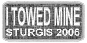
Compared to last year, Sturgis–a small town of 6,500 quaintly nestled in the scenic Black Hills of western South Dakota–did not seem to have changed much. But STURGIS–the world’s largest motorcycle rally and biker event–was not the same. Yes, upon arrival I parked at the same Sturgis H-D to buy and ship the same expensive souvenir shirts, and had the same lady at the same vendor booth on Main Street sew on my “I RODE MINE” patch. And yes, I then walked the same two blocks to the Broken Spoke Saloon to enjoy the first of many hot bands and cold brews, just as I did in 2005. In fact, about the only big difference between my first day in Sturgis this year versus last is that last year’s ended with one too many beers in my belly, while this year’s ended with one too many nails in my rear tire. But a quick shot of ThreeBond Seal’n’Air and a quick stop at Moon’s Cycle Repair took care of that.

No, the difference I allude to was not so notable in Sturgis itself as it was on the way there and back. The difference was in the number of bikes being rode versus the number of bikes being towed: Last year, I remember the I-90 stretch from Sioux Falls to Rapid City as a thundering stampede of Sturgis-bound cyclists. This year, I’d almost swear I saw as many trailers as I did two-wheelers.

Motorcycle riding is more about the journey than the destination, and that goes double for Sturgis. Sharing the ride, the risks and the waves with thousands of fellow bikers over hundreds of miles of highway, swapping stories and smiles at stops along the way, is an integral part of the “Sturgis experience” for me. I do not understand why any true rider would want to pass that up.

Sure, the professional racing and commercial show bikes have to be trailered. And it would not make much sense to try to ride one of those 60K+ chrome penis extensions cobbled together by Billy [poor guy], Paulie or Russell across country to Sturgis, when you can barely wobble it across town to Hooter’s. But if you have a well-maintained bike, a good back, a comfortable seat, riding gear, and saddlebags or luggage, why have it towed when you could’ve rode?!?

You are not doing it to save money. What you paid for your trailer is probably more than what it would cost to make a touring-capable motorcycle road-ready. And mile-for-mile, it almost certainly takes less gas, oil and maintenance to keep two wheels rolling than to have four or more towing. And you’re not doing it to save time, either. I’ve ridden over 1,500 miles in under 24 hours more than once, and I seriously doubt you’ll make better time pulling a trailered bike. And no, you don’t have to ride anywhere near that far or that fast to get to Sturgis…

Live to TowFrom anywhere in the lower 48 United States, the distance to Sturgis is no more than 2,412 miles. For most riders, the actual distance will of course be much less. Compute what the distance is for you, and then divide that number by four. You’ll probably end up with a mileage figure that is within your daily riding range. Ride that many miles for four days … and you’re in Sturgis! Party hardy, cruise the Blacks Hills of South Dakota and Wyoming and sightsee for six days, then enjoy your four-day ride back home. Four plus six plus four equals fourteen days … and one Hell of a great two-week vacation for any motorcyclist who truly lives to ride.

One final tip: If you’re not a camper and willing to ride a few extra miles, you can save big bucks by booking your motel room in Gillette Wyoming. Consider the National 9 Inn, which offers clean rooms, free 24-hour coffee, on-site cafe and lounge, free cafe breakfasts, room service, Internet access and terminal, and next-door laundry service … all for a rate that is 75% less than what I’ve paid for inferior accommodations in Rapid City. You can reserve online, or call 307-682-5111 and tell the manager Deb that Bruce sent you. And after you check in, cruise over to Jakes Tavern for a cold one!

Live to TOW? I say NO!

Until Next Time … Ride Long, Ride Free!

My 100CCC Insanity: Part 2

August 2006

Part 2 of 2: SDO to JAX

Tuesday May 30, 2006 marked the end of seven days and almost 5,500 miles on two wheels for me. The lion’s share of this saddletime was devoted to my successful completion of what the Iron Butt Association calls the CCC Gold or 100CCC Insanity. The 100CCC requires that you ride from coast to coast to coast in 100 hours or less and that each of the back-to-back, coast-to-coast runs be completed in 50 hours or less. In this case, I rode from Jacksonville Beach, FL to San Diego (Ocean Beach), CA and back again, covering 4,728 miles in 95 hours 49 minutes.

Leg 4: San Diego to Ocotillo (Miles: 94… Ride: Awesome)

According to the IBA rules for the 100CCC, the run clock for my ride back to Jax Beach started automatically at 5:59am PT, Saturday May 27, exactly 50 hours after the start of my westbound ride. I slept right through that event, however, having elected to get in a couple more hours of rest and a bit of sightseeing before I headed back east.

I awoke to overcast skies, and began mentally preparing myself to face the same “tempest on the mountaintop” that had almost bested me a few hours before. Soon after I was eastbound on I-8, however, things changed rapidly for the better. As I began weaving my way up and through the Laguna Mountains, I broke through the low-lying clouds and into sunny skies. Mother Nature’s fury was spent, and my reward for enduring it was some of the most breathtakingly beautiful mountaintop views you can imagine. And just to make things absolutely perfect, the wind I fought so hard for so long riding west, was now at my back riding east. I didn’t just ride across the Lagunas to Ocotillo … I’d say it was more of a glide.

Leg 5: Ocotillo to Sonora (Miles: 1012… Ride: Pleasurable)

Ocotillo CA had the same strange isolated winds as it had the night before, but in daylight they were not nearly so intimidating. A quick fuel stop and then it was east across the Imperial Valley, which can aptly be described with one word: Sand. Flat empty stretches of sand … irrigated crops growing in sand … Sahara dunes-looking mountains of sand … all the way to Arizona.

Eighty-five miles east of Yuma, I pulled over in the one-horse town of Sentinel AZ. It looked like one of those “last chance” ghost towns from Route 66 or Death Valley. For a moment I thought it might be deserted, but then I heard the sound of a compressor running, and headed for the door. Inside was a general store from yesteryear: an ancient soft drink cooler, a few sparsely stocked shelves of basics, a dusty rack of cheap plastic kids’ toys, and everywhere that smell, that corner store laundry soap and bubble gum smell. I felt like I was back in my boyhood days and I wanted to stay, but the venerable proprietor was looking at me like I was from another world. I sadly remembered that I was, and returned to my eastward trek.

Long distance riding gives you a lot of time to think, and I find that to be downright therapeutic. It’s not healthy, though, to turn too much attention inward, get lost in thought and “zone out”. That happened to me somewhere between Tucson and Benson AZ. I came to from a daydream in the middle of empty desert, looked down at my fuel gauge, and realized I was running low on gas, did not know where I was, and had no idea how far it was to the next pump. Ughh! I can’t honestly say if this was a fatigue-induced event or simply a brain fart, but for a moment I simply did not know what to do. Then a quick mental coin toss, and I decided to keep rolling eastward and hope for the best. I slowed to save gas, and agonized as mile after mile after mile yielded no signs of civilization or reasons for hope. Then at last, I top a rise and see a billboard inviting me to take the next exit to see “The Thing”, a tourist attraction complete with 24-hour gas services. Well, I never did see “The Thing” … but you better believe I was happy to see those gas pumps!

Those wicked crosswinds were still blowing as I once again rode through Road Forks NM, but this time I was prepared and nothing was lost. From there, a steady tailwind made for easy riding, and I made Deming around dusk. Two hours more took me through El Paso, and by midnight I was near Van Horn and into the Central Time Zone.

Remembering that 24-7 gas stops in West Texas are few and far between, I was watching for my next opportunity to fill up. According to the exit signs, Balmorhea was it. Sure enough, the lights were on outside the Fina c-store, but the gas pumps wouldn’t take any of my cards, and as it was 1:49 am the store was closed. I thought my luck had run out, but then a light came on, and then another, and then a kind but sleepy old cowboy in his undershirt stepped out of the store to tell me his credit card rig was busted, but I could pay cash if I needed gas. I did, and I thanked him. I pumped my gas, and headed back into the starry Texas night. Three hours more and no deer had crossed by path, so I rolled safely into the parking lot of the Best Western Sonora at 4:48am, Sunday May 28.

Leg 6: Sonora to Jax Beach (Miles: 1,259… Ride: Punishing)

As was the case on my westbound ride two days before, I checked out of the Best Western Sonora roughly four hours after I had checked in. Before, I felt fully rested, but this time was not the same. Perhaps I’d slept as long, but not as deeply. Or perhaps fatigue was catching up with me. Either way, I began this last leg of my ride feeling more groggy than refreshed. I must have still been in a mental haze when I stopped for gas 55 miles later, as I paid and then pulled out without pumping, and had to loop back for an embarrassing do-over.

Except for gusty winds and hard rain from Flatonia to Houston, the remainder of my ride eastward across Texas was uneventful. Mostly sunny skies prevailed as I crossed into Louisiana, but heading east on I-12 out of Hammond that suddenly changed. In less than three minutes, the skies went from blue to black, and then rain started coming down in sheets. I stopped under an overpass, donned my hard weather gear, and rolled back out into the torrent. Thanks to Zooke Anti-Fog my visor didn’t fog over, but the rain was coming down so hard that all I could see in front of me was a wall of water. Then once again, when I needed a break, Providence gave it to me: A cager in a small red car saw my distress, eased in front of me, turned on his emergency flashers, and guided me through the downpour until the rain subsided. What a nice guy!

Once I reached Covington LA, what lay before me was a straightforward night ride of 560 miles. Normally, this would’ve been water off a duck’s back, even with the intermittent mist that fell all along the way. But by this point in the run, things were no longer “normal”. I was wet … I was tired … and I was sick of being wet and tired. Still, I knew that most of the challenges were behind me now, and all I needed to do was hang on to finish the run.

I made it to Bonifay FL by 12:45am, where I loaded up on Red Bull and peanuts to recharge myself for the last 273 miles. Still, those final few miles proved far more grueling than the thousand that came before them. There’s just something about riding through the wee hours of the morning that drains you (well, me anyway), and when you’re doing it for the fourth consecutive night, the effect is really amplified. So, I have to give credit where credit is due:

If I had not read and internalized Don Arthur’s classic article on “Fatigue and Motorcycle Touring”, I might not have finished the 100CCC, and it is quite possible that my ride might have ended in injury or death. Thanks to Don, however, I had done just about everything I could to be physically ready for the ride … to mitigate fatigue along the way … and to recognize and cope with its effects towards the end. If ever there was an article that should be on every distance rider’s required reading list, Don Arthur’s Fatigue and Motorcycle Touring is it.

100CCC Insanity Jacksonville Beach FLDawn’s early light appeared in the east as I entered Jacksonville from the west. And as the sun rose, so did my spirits. I-10 terminated at I-95 south, then it was a quick sprint across 202 to A1A and Jacksonville Beach. The seemingly unbearable fatigue of just two hours before was completely gone, replaced in its entirety by the elation of imminent victory. A c-store gas receipt timestamped my end-of-run at 6:48am, Monday May 29. I had ridden from coast to coast to coast, and done it in less than 100 hours. One final round of witness signatures and sand scooping with biker buddies Kevin and Debbie Dineen (Jacksonville FL) and Axel and Vicky Wojnar (Davie FL), and the 100CCC prize was mine.

Until Next Time … Ride Long, Ride Free!

My 100CCC Insanity: Part 1

July 2006

Part 1 of 2: JAX to SDO

Tuesday May 30, 2006 marked the end of seven days and almost 5,500 miles on two wheels for me. The lion’s share of this saddletime was devoted to my successful completion of what the Iron Butt Association calls the CCC Gold or 100CCC Insanity. The 100CCC requires that you ride from coast to coast to coast in 100 hours or less and that each of the back-to-back, coast-to-coast runs be completed in 50 hours or less. In this case, I rode from Jacksonville Beach, FL to San Diego (Ocean Beach), CA and back again, covering 4,728 miles in 95 hours 49 minutes.

Leg 1: Jax Beach to Sonora (Miles: 1,254 … Ride: Mundane)

On Wednesday May 24, I rode a leisurely 351 miles from Miami Beach to Jacksonville Beach FL, where I checked into the Best Western Oceanfront. After securing my bike and gear, I walked the few steps down to Bukkets for their happy hour seafood specials and the last few ounces of distilled spirits I’d be imbibing for several days.

100CCC Insanity Jacksonville Beach FLI was up well before dawn the next morning, packing my bike, sucking down some hot coffee and a cold continental breakfast, and preparing for my start-of-run witnesses to arrive. Jacksonville riding buddies Kevin and Debbie Dineen rolled in as promised just after 6:45am. We dashed to the ocean’s edge, where they photographed me collecting a traditional vial of sand and sea water. Then we quickly filled out some IBA witness forms, saddled up, and rode a couple of blocks to the Texaco c-store located where US-90 terminates at A1A. There, I logged a gas receipt timestamp to start my run clock at 6:59am ET, Thursday May 25. Kevin and Debbie then escorted me down A1A to 202 and west to I-95, where we waved good-bye as I turned north to connect with I-10 and head west.

The air was warm, the skies were clear, and for the rest of the day and on into the evening, the ride across the Florida panhandle into Alabama, Mississippi, Louisiana, and halfway across Texas to Sonora was pretty much mundane mile-eating. Not that it wasn’t enjoyable, but I’ve ridden that stretch of I-10 far too many times for it to stir any wonder or excitement.

Leg 2: Sonora to Ocotillo (Miles: 1,019 … Ride: Challenging)

I checked out of the Best Western Sonora at 7:09am CT, Friday May 26, barely four hours after I had checked in. I felt fully rested, perhaps exhilarated, and powerfully hungry. I put a few miles on the bike and then pulled into Calib’s Country Kitchen in Ozona for a hot breakfast. This stop proved to be a diner’s delight, but a distance rider’s disaster: The steak that came with my fried eggs and flake biscuits was mouth-wateringly delicious, but it took them nearly 30 minutes to serve it up, leaving me no choice but to choke it down as quickly as possible. Lesson learned … next time, back to Waffle House … rarely fantastic, but almost always fast.

Refreshed and refueled, it was now time to cross the miles and miles of distant hills and brushy desert plains that is West Texas. Wide open expanses and empty roads made riding a pleasure and high speeds a temptation, but a steady wind from the west-southwest was taking an unexpected toll on my gas mileage and fuel tank range. The hop from Ozona to Fort Stockton was no problem, but making it from there to Van Horn with an open throttle, 4.9 gallon stock tank and thirsty Mikuni carburetor was nothing short of a miracle. Realizing I was in trouble, I slowed down to 60 when I hit reserve so as to optimize my remaining miles per gallon. But even doing that, I basically coasted into the first station on the east side of town, my gas needle having been on flat dead empty for a couple of the longest minutes of my life.

From El Paso westward, an ever-increasing headwind served as a constant reminder to keep my eye on the fuel gauge, and I willingly traded the efficiency of maximizing miles between stops for the security of knowing I would make it to the next one. On across the high desert of New Mexico I rode, dodging dust devils, crossing the Continental Divide near Separ, and continuing westward to an eerie Stephen King truckstop of a place called Road Forks. Here, the wind suddenly shifted and increased in intensity. In less than a second, my favorite midnight blue bandanna was sucked right out of my vest pocket. Two seconds more, and the long, heavy string that fastens the left side of my riding vest to the back was literally untied, unlaced and carried away as if by some evil, unseen hands. I fought to keep my bike in one lane and hang on to the pieces of my vest until, just as Road Forks appeared in my rear view mirror, the wicked crosswind subsided as quickly as it had arisen. I pulled over, packed away what was left of my vest, looked back to say goodbye to my bandanna, and headed on into Arizona.

In Casa Grande, I forked off I-10 to I-8, continuing westward towards Yuma through the Sonoran National Desert Monument. This route took me through a couple of hundred miles of some of the most beautiful desert I’ve ever seen, complete with awe-inspiring stands of hundreds of giant saguaro cactus (or is it cacti?). Then somewhere west of Gila Bend the sun finally set. In a few hours more I crossed the California state line and Imperial Valley, making my last gas stop before San Diego near its western edge in Ocotillo.

Leg 3: Ocotillo to San Diego (Miles: 90 … Ride: Awful)

As I approached Ocotillo CA, the winds I’d been fighting all day and night picked up with a suddenness and fury similar to what I’d experienced at Road Forks NM. Little did I know then, but from this point westward–until I rolled out of the Laguna Mountains and into San Diego–I’d be fighting every minute to keep my bike upright and on the road.

Refueled once more, I donned my leather jacket and rolled out into the dark blustery night, continuing westward and upward into the mountain passes. With each one thousand foot increase in elevation, a road sign informed me of my progress, and the winds seemed to grow more determined to halt it. 1,000 feet above sea level … then 2 … then 3 … then 4,000 feet and higher. There, Mother Nature decided to throw what I can best describe as a blowing white fog with fast-melting snow into the mix. I think I was riding through clouds. The temperature plummeted, visibility dropped to a few feet, and my forward progress slowed to a crawl.

At this point, I no longer harbored any concerns about making San Diego on time. My only objective was to make it through the mountains alive. I kept going. Over one summit, then down, then up over another summit, then down, then again and perhaps again. I remember seeing signs for Tecate Divide and Crestwood Summit, but I was too busy or blind to see the names of the others. Then finally, after two hours of riding through winds and weather that should only appear in nightmares, I rounded a bend and the lights of San Diego spread out before me.

100CCC Insanity Ocean Beach CASan Diego normally has only two rainy days in May, and of course this was one of them. But after what I’d just ridden through, I barely noticed. I-8 carried me right on into Sunset Cliffs Boulevard, which led me to Sam’s Shell Service, where a timestamped gas receipt marked the end of my westbound coast-to-coast ride at 1:12am PT, Saturday May 27. I had covered 2,363 miles in 45 hours 13 minutes. Then, one short mile more to the Ocean Beach Hotel for witness signatures, a ceremonial scoop of Pacific sand and seawater, and finally some much needed rest.

Next month: My 100CCC Insanity Part 2, SDO to JAX!

Online Maps

June 2006

Long distance motorcycle riders have four basic means of routing and navigating their tours and timed runs: printed maps, online maps, GPS (Global Positioning System) devices, and if all else fails, asking for directions. Our focus this month is the second of these, online maps.

99% of all Internet users reference search engines to find what they are looking for on the World Wide Web, and the three most frequently accessed are

Type “online maps” into the search box of any of these, and hit the “Search” button. Within seconds you’ll be one click away from hundreds of web-based mapping and navigation resources. But as you may surmise after a little browsing, all major online map services generally rely on one of two companies to provide much of their digital mapping and road data content: Navteq or Tele Atlas. Here are five of their most prominent customers:

AOL Mapquest ( https://www.mapquest.com/ )

Mapquest was one of the first online map services, and is now a subsidiary of AOL. Like its parent company, Mapquest is not exactly keeping up with the Joneses technology-wise. As of this writing, for example, they are the only major online map service that has not incorporated satellite imagery or aerial photographs to augment their graphical maps.

Ask.com Maps & Directions ( https://maps.ask.com/maps )

Ask.com’s new online map technology trumps the competition by being first to offer a topical relief view as well as street (graphical) or aerial. Unfortunately, however, leading edge is often only a step away from bleeding edge. As The Map Room blogger Jonathan Crowe points out: “Ask.com relief maps have a significant flaw–one that the Dutch would certainly notice: any land below sea level is shown as being under water.”

Google Maps ( https://maps.google.com/ )

With the new Google Maps, and its related Google Earth “3D planet interface”, there can be no question that Google plans to use superior technology to come from behind and ultimately dominate the online map web segment just as they did with search engines. Google Maps views include Map, Satellite and Hybrid, and Google Earth’s imagery and interface are dazzling. But if you want to quickly and reliably locate convenient motels or 24-hour gas stations, you’d best look elsewhere … for now.

Windows Local Live (now Bing Maps) ( https://maps.bing.com/ )

Microsoft’s Windows Local Live beta version sports road and aerial views along with a user interface that includes a scratch pad. The scratch pad I understood, but the rest of the interface had me scratching my head. You can use it to locate businesses and business categories, but it doesn’t find anywhere near as many as Yahoo! does. And I’m still trying to figure out how the hell to make it print. I think the Gates gang needs to trailer this puppy back to the garage and break out the tools.

Yahoo! Maps ( https://maps.yahoo.com/ )

Yahoo! Maps offers logically ordered Map, Hybrid and Satellite views combined with an interface as intuitive and easy to use as its Classic Maps predecessor, which for now is just a reassuring click away. Getting directions from A to B is as simple as before, and their database of motels, restaurants, gas stations and other businesses along the way eclipses those offered by Google or MSN. And printing is a no-brainer.

Each of these online maps offers unique features with different twists, and I recommend you check out all five. But for me and for now, if I could use only one, it would be Google.

Until Next Time … Ride Long, Ride Free!

Iron Butt to Texas & Back: Part 2

May 2006

Part 2 of 2: A Hard Ride East

For me, Monday March 13 marked the end of five days and almost four thousand miles in the saddle. My trip began with a 1,610 mile Iron Butt BunBurner 1500 ride from Miami Beach FL to Round Rock TX via Atlanta, Birmingham, Jackson, Shreveport, Dallas and Bruceville. I completed this BB1500 in 29 hours 5 minutes road time, 33 hours 27 minutes total time. My trip ended with a 2,083 mile Iron Butt SaddleSore 2000 ride from San Antonio TX to Miami Beach FL via Dallas, Texarkana, Little Rock, Memphis, Nashville, Knoxville, Asheville, Charlotte, Columbia, Savannah and Jacksonville. I completed this SS2000 in 36 hours 30 minutes road and total time, as I did not stop for a motel sleep break. Last month I told you about my Wet Ride West. This month, let me tell you about my Hard Ride East:

As I headed north on I-35, the gray clouds over San Antonio quickly gave way to a warm and sunny Texas spring morning. An incessantly powerful March wind was at my back, noticeably improving my fuel efficiency, and making it difficult to keep the needle under 90. In no time flat, the tailwind whisked me all the way to Dallas, where I connected with I-30 and headed towards Texarkana.

East of the DFW metroplex I rode into the rolling, open plains of northeast Texas. There, my much appreciated tailwind became an unceasingly annoying crosswind that had me riding at a lean all day and well into the night. But for the moment, the sun was bright, the sky was blue, and I was warm and dry. That was good enough for me.

I made it almost all the way across Arkansas before stopping in Palestine at sundown to don my lid and leathers. From there, it was a short hop to the Mississippi River and across into Memphis, a city with a dazzling nighttime riverfront and downtown skyline. Continuing east towards Nashville, I took a break to grab some grub in Jackson Tennessee, the hometown of that famous railroader Casey Jones. His museum was right next to the Waffle House where I ate, but it was too late for me to do much more than take a look at his restored and retired engine. Then it was on through Nashville and eastward to Knoxville, where I entered the Appalachians and the Eastern Time Zone around 3:00am.

In retrospect, I should’ve pulled into a motel and got some shut-eye at this point. I could have done so and still completed my SS2000 within the required 48 hours. And had I done so, I would have experienced the most beautiful and challenging segment of my ride fully rested and with the increased safety and scenery of daylight. I should have … but I didn’t. I kept going.

To get from Knoxville to Asheville on I-40, you have to go through Hartford, Tennessee and Iron Duff, North Carolina. And between Hartford and Iron Duff are 28.5 miles of nothing but uphill and downhill twists and turns as the road winds its way through a mountainous area where the Great Smoky Mountains National Park, Cherokee National Forest and Pisgah National Forest converge at the Tennessee/North Carolina border, just east of the 6,621 foot peak of Mount Guyot. It reminded me of the Iron Mountain Road (US-16A) near Mount Rushmore, but on a much grander scale. Fatigued by more than 22 hours in the saddle, this proved to be one of the most daunting stretches of interstate I have ever ridden. I hope to ride it again someday … when I am rested and alert enough to enjoy it … and in daylight, so I can appreciate more than just the shadows of what must be an abundance of natural beauty.

The sun arose and lifted my spirits as I finished breakfast and a third cup of coffee at the Huddle House in Asheville. From there, I rode a scenic 80 miles to Hickory as I-40 wound its way through peaceful valleys bounded by majestic mountains. Then it was time to turn south on US-321 to Gastonia, east on I-85 to Charlotte, and on down through South Carolina via I-77 to I-26 to I-95 near St George. I then rode uneventfully through the lowlands of Carolina and Georgia, which merged seamlessly into the familiar flatlands of the Sunshine State. Six hours more and I reached the end of my 2,083 mile run. I was back on the Beach, sleeping soundly and no doubt snoring loudly, dreaming about my next ride…

Until Next Time … Ride Long, Ride Free!

Iron Butt to Texas & Back: Part 1

April 2006

Part 1 of 2: A Wet Ride West

For me, Monday March 13 marked the end of five days and almost four thousand miles in the saddle. My trip began with a 1,610 mile Iron Butt BunBurner 1500 ride from Miami Beach FL to Round Rock TX via Atlanta, Birmingham, Jackson, Shreveport, Dallas and Bruceville. I completed this BB1500 in 29 hours 5 minutes road time, 33 hours 27 minutes total time. My trip ended with a 2,083 mile Iron Butt SaddleSore 2000 ride from San Antonio TX to Miami Beach FL via Dallas, Texarkana, Little Rock, Memphis, Nashville, Knoxville, Asheville, Charlotte, Columbia, Savannah and Jacksonville. I completed this SS2000 in 36 hours 30 minutes road and total time, as I did not stop for a motel sleep break. Next month, I’ll tell you about my Hard Ride East. But first, let me tell you about my Wet Ride West:

The ride from I-95 to the Florida Turnpike to I-75 and on into Georgia was sunny, warm and uneventful all the way to Atlanta, where I looped I-285 to hit I-20 east. This gave me plenty of time to get accustomed to my new Icon Mainframe full coverage helmet, which I ordered online from RideGear.com. Above 70 degrees, wearing a full coverage lid standing still is somewhat like holding your head in a warm oven. Once you get rolling, though, the ram-air ventilation system kicks in and it’s not so bad. And the faster you go, the more air you get. (Maybe this contributes to the crotch rocketeers’ need for speed.)

I had logged onto the National Weather Service before leaving, so I knew I’d be passing through a severe weather front somewhere west of Atlanta. Sure enough, cold winds and dark clouds were waiting for me at the Alabama state line. By the time I hit Birmingham, the black skies were streaked with lightening and cold rain was coming down in sheets. In Bessemer, I pulled into a ghetto c-store, donned my wet weather gear, and then eased up onto the interstate and back into the torrent. Strong northerly gusts were now blowing freezing rain and sleet–and frequently me and my bike–from one side of the road to the other. At times, the wind slowed me down to a 30mph crawl, but I was fully armored and determined to keep going. After all, this was the perfect opportunity to test my hard weather gear in truly adverse conditions.

I may have cursed the suffocating heat of my full coverage helmet earlier in the day, but I was sure thankful to have that insulating warmth and protective shield now! My H-D hard weather jacket and pain-in-the-ass-to-put-on “waders” did their job as well, as (for the most part) did my waterproof H-D Gore-Tex leather gloves. But like a chain, a suit of weather armor is only as strong as its weakest part, and that proved to be my (not) “water resistant” boots. As I fought the winds riding west through Tuscaloosa, the cold rain kept falling … and my boots began filling. My feet were awash with ice cold water, and I truly began to appreciate the age-old axiom that you can’t stay warm unless your feet stay warm.

East of Meridian Mississippi, I finally broke through the front into clear night skies and dry road conditions. The ride would actually have become quite enjoyable at that point, had it not been for my cold, wet feet. So when I stopped for gas in Newton, I drained my boots and put on dry socks. This helped some, but within minutes the remaining moisture in the boots once again soaked through my socks to ice my numbing feet.

I kept riding westward on I-20, across the Mississippi River at Vicksburg and on into Louisiana. But with each passing mile, I could feel more and more of my precious body heat leaking out around my toes. I stopped for gas in Minden, and began to shiver as I pumped. The water in my boots got the best of me, so I crossed the street and checked into the Exacta Inn around 2:00am. With the room heater running full blast, by 6:20am all my gear was dry and I was warm, rested and back on the road to the Lone Star State.

Sweet Mother Texas welcomed her wayward son home with clear blue sunny skies. By the time I turned south on I-35 and made it through Waco, it was too warm for lid and leathers, so I stopped to shed them both in Bruceville. From there it was an easy ride on into Round Rock and the end of my run. The next day, I made a beeline to Cavender’s Boot City and bought a pair of waterproof Georgia Mud Dogs, available online at GeorgiaBoot.com.

I’ve put over two thousand miles on those boots since then, and I can assure you that for the money they are the warmest, driest and ugliest boots you’ll find anywhere.

Until Next Time … Ride Long, Ride Free!

Lids Yes … Lid Laws, No

March 2006

This is the seventh installment in a series about the combination of rider, ride, route and resources required to endure and enjoy long distance riding (LDR). Our resource focus this month is helmets.

There is a reason why some writers refer to endurance riding as “insanity” and distance riders as a “self-correcting problem.” That reason is that motorcycle safety is an oxymoron, and LDR makes it even more so.

Riding a motorcycle even one mile is risky. Riding a thousand miles or more in a day multiplies that risk. But for distance riders like me, the more the risk the greater the thrill. I am absolutely addicted to that euphoric combination of adrenaline and endorphin production that increases with the distance and duration of the ride … a sensation I call rider’s high.

Sensations aren’t worth much, though, without a brain to be stimulated and a mind where they can be assimilated. Those things reside in a head … so that head needs to be protected … and that means wearing a helmet.

“WHAT?!?” you may say. “You mean IronBoltBruce the bikers’ rights advocate is recommending you wear a helmet? How can that be? Has he sold out to the Safety Nazis?!?”

Absolutely not. My position is simple: LIDS YES … LID LAWS NO.

One of my biggest political challenges is trying to get the extremists on both sides of the helmet law issue to stop spouting nonsense long enough to realize that it is both possible and prudent to be PRO-HELMET while at the same time ANTI-HELMET LAW. Here is why:

Wearing a helmet increases the safety of a motorcycle rider. Period. Thinking otherwise is about as dumb as taking a knife to a gunfight. BUT, that is not to say that we should mandate helmet usage in the name of saving lives. If we concede on that basis, some NHTSA numbskull may propose we can save even more lives by banning motorcycles altogether. And there ends our lifestyle, my brothers and sisters. As Virginia biker Matt Danielson recently posted:

“[Some] say that the government should mandate helmet use because those who choose not the wear helmets create a public burden due to the costs of treating injuries relating to their choice. If we take that argument at face value, should not the government regulate our diets and exercise, and ban drinking and smoking? Obesity and smoking related diseases costs the public billions. Don’t we all bear the burden of another’s choice to eat burgers as opposed to salad or fish? However, no one is going to suggest that the government take such measures (of course I could be wrong again).”

I always wear a helmet on my long rides, but I appreciate the fact that I have a choice as to when and where I don my lid. I am in favor of saving lives, but I am against laws that limit personal freedoms. I think that if we let the politicians force helmets today, tomorrow they may take away our reason for needing one.

My position on helmet usage is pretty much the same as that of the American Motorcyclist Association (AMA), which I encourage you to go online and read here:

https://americanmotorcyclist.com/voluntary-helmet-use/

Until Next Time … Ride Long, Ride Free!

Wind Chill & Solar Radiation

February 2006

Over the Christmas holidays, I attempted two Iron Butt runs … a 1,046 mile ride–from Miami Beach (FL) to Elizabethtown (KY)–which I aborted after 743 miles due to imminent hypothermia … and a 1,194 mile ride–from Atlanta (GA) west to Birmingham (AL), south to Mobile (AL), east to Jacksonville (FL) and then south to Miami Beach–on which I survived the cold and succeeded.

Same bike and rider. Similar road, traffic and weather conditions. So, why did I fail in my first attempt? Because …

I did not properly calculate and fully respect the impacts and interactions of cooler temperatures, wind chill and the presence or absence of solar radiation.

Any distance riders from Alaska or Canada reading this article may be chuckling at this point, but Sunbelt cyclists considering a northbound winter run should heed what I have to say:

The human body loses heat when it’s exposed to cold air. The greater the wind speed, the faster it loses heat. We can feel or sense this heat loss, which is known as wind chill. To estimate the heat loss based on temperature and wind speeds, the National Weather Service (Weather.gov) created a Wind Chill Temperature (WCT) Index. This wind chill index was developed to describe the relative discomfort and/or danger resulting from a given combination of wind and temperature.

Before I left Miami Beach for Elizabethtown, I checked the weather forecasts along my route, and found expected daytime highs in the low 50s with nighttime lows in the 30s. I had ridden in 26 degree weather before, so I figured that the gear that kept me warm enough to ride then would suffice for what I’d be riding through now….

I figured wrong. My sunny daytime ride north through Florida and into Georgia was cool, but comfortable enough. Once I hit the outskirts of south Atlanta, though, Christmas shoppers slowed traffic to a crawl, the warming sun began to set, and the temperature started to plummet. By the time I hit the northern I-285/I-75 interchange, my bandanna-covered cheeks were stinging, my Gore-Tex gloved fingers felt like they were packed in ice, and I had to constantly flex my leather-chapped leg muscles to keep them from seizing. I willed myself a few miles further north to the Acworth exit, but there I succumbed to the Ramada Limited’s promise of a hot shower and a warm bed. I had ridden 743 miles, but my Iron Butt was now a Frozen Butt, and I could ride no more.

My mistake was assuming that the gear that kept me warm enough to ride in the 20s in daylight would also keep me rolling through nighttime temperatures in the 30s. I had not considered the interaction of wind chill and solar radiation. Yes, the wind chill index for 70 MPH at 26 degrees may be 3, but bright sunshine can warm the apparent temperature back up to 21. Run that same speed at night in 32 degrees, and what you feel is a bone-chilling 12!

What I learned from my failed first attempt, I applied to make my second run a (concededly shivering) success: I found a warmer way to rig my face and neck cover. I bought glove liners, and donned a pair of Under Armour (UnderArmour.com) ColdGear leggings under my jeans and chaps. I rode mostly north to south, which gave me the psychological advantage of knowing that no matter how cold it got, it would probably get warmer if I just kept going. And last but not least, I calculated rather than guesstimated my wind chill factors. You can do the same with this:

Motorcycle Wind Chill Chart

Until Next Time … Ride Long, Ride Free!